Glen Lednock Wind Farm
Low Carbon is proposing a new wind farm, to be known as Glen Lednock Wind Farm, located southwest of Loch Lednock Reservoir in Glen Lednock on the Invergeldie Estate, approximately 2.8km north of St. Fillans and 8km northwest of Comrie in Perthshire. It will be located entirely within Perth and Kinross Local Authority Area.
Welcome to
Glen Lednock Wind Farm


Craig Cunningham
Senior Project Development Manager
Low Carbon is proposing a new wind farm, to be known as Glen Lednock Wind Farm, located southwest of Loch Lednock Reservoir in Glen Lednock on the Invergeldie Estate, approximately 2.8km north of St. Fillans and 8km northwest of Comrie in Perthshire. It will be located entirely within Perth and Kinross Local Authority Area.
The project will generate greater than 50 megawatts (MW).
A Section 36 application was made to the Scottish Government’s Energy Consents Unit in June 2025.
The Section 36 application can be viewed here:
Scottish Government (Energy Consents Unit) application
The land is owned by Oxygen Conservation. Their vision for the estate is to achieve positive environmental and social impact through a diverse range of activities, including renewable energy generation.
To further understand why they are exploring wind at Invergeldie, please find out more in the Landowner section.
Proposed Development
The installed capacity of the Proposed Development would be over 50MW comprising up to 19 turbines (reduced from 25 turbine at scoping). 16 turbines have a maximum ground to blade tip height of 200 metres and 3 with a maximum ground to blade tip height of 180 metres. The number and location of the turbines and associated infrastructure has been subject to thorough consultation and has now been finalised following a detailed iterative design process.
The Proposed Development also includes habitat restoration and enhancement measures which are further defined within the Environmental Impact Assessment.
Any predicted environmental effects arising from the Proposed Development will be mitigated as far as reasonably possible. Where necessary, additional specific mitigation measures will be committed to further reduce adverse effects during the construction, operational and decommissioning phases of the development.
Low Carbon champions biodiversity as a critical milestone on the journey towards a low-carbon future and is committed to including within the Proposed Development a comprehensive land and biodiversity management programme, aligned to the unique conditions and circumstances of the site.
Benefits of Low Carbon Development
Across our portfolio of renewable energy projects, we have championed biodiversity as a critical milestone on the journey towards a low-carbon future.
Wind resource is plentiful in Scotland and can be utilised to provide security of supply and add to the renewable energy generation mix.
Biodiversity
It is important that the site is improved for nature and demonstrates a biodiversity enhancement, thus helping to protect and improve new and existing habitats.
Planting
Where appropriate, we will look to enhance the site with additional planting of native species.
Public Rights of Way
We intend to keep access to public rights of way open throughout construction and operation of the windfarm, subject to health and safety constraints, and will seek to improve access wherever possible.
Community Benefit Fund
Low Carbon is committed to delivering Community Benefit of £5,000 per MW installed per annum (index linked) for the operational lifetime of Glen Lednock Wind Farm, in line with the Scottish Government best practice guidance. Based on the current layout this would provide a community benefit fund of £589,000 per annum.
Foundation Scotland will provide independent support and advice to the community to agree the best approach to structuring and administering funds.
Low Carbon offers shared ownership in Glen Lednock Wind Farm, in line with Scottish Government best practice principles. We will work with communities to explore shared ownership options with support provided by Local Energy Scotland.
Supply Chain
A variety of suppliers are sourced throughout the development, construction, operation and decommissioning of a wind farm. Where possible, Low Carbon will seek to appoint suppliers offering local employment and/or apprenticeships. Please add your local business to the Supply Chain Register
News
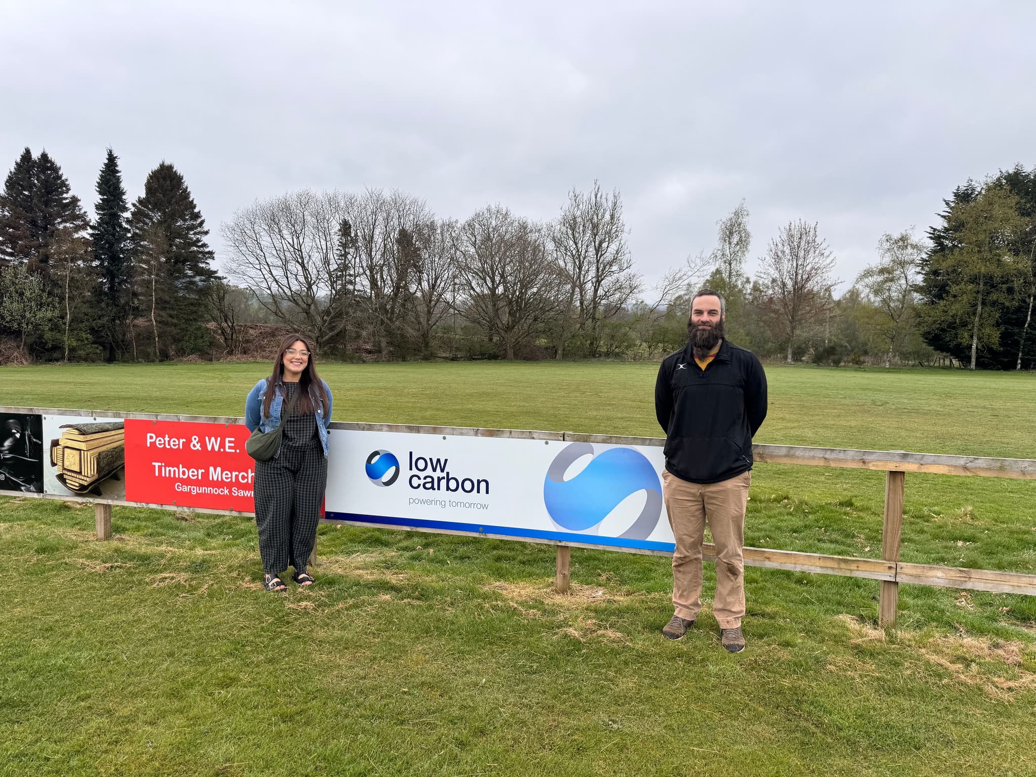
Supporting the Future of Rugby in Crieff & Strathearn
We’re pleased to support Crieff & Strathearn Rugby Club with a donation towards new clubhouse furniture, helping enhance the space used by players, volunteers and the wider community.
The club plays an important role across the Strathearn area, drawing players from Crieff, Comrie and surrounding communities. Alongside senior rugby, the club is supporting junior participation through a well-established partnership with Morrisons Academy, helping provide coaching and game opportunities for young people and strengthening pathways into the sport.
The donation will support improvements to the clubhouse, creating a more welcoming and flexible space for senior and junior teams, training sessions and community events in the years to come.
“Grassroots sports clubs like Crieff & Strathearn Rugby Club are vital to local communities,” said Patricia Carr, Senior Stakeholder Manager. “It’s great to support a club that is investing in its facilities and in opportunities for young people to get involved in rugby locally.”
Tom Di Virgilio, President of Crieff & Strathearn Rugby Club, added:
“We’re really grateful for this support. Improving our clubhouse helps us make better use of our facilities for players of all ages and strengthens the club as a hub for the local community.”
View all NewsFAQs
How do I comment on the proposal?
Our Section 36 application has now been submitted to the Scottish Ministers, representations can be made via the Energy Consents Unit online portal.
Any representations to the application may be submitted to Scottish Ministers via the Scottish Government Energy Consents Unit, by email to representations@gov.scot; or by post to Scottish Government Energy Consents Unit, 4th Floor, 5 Atlantic Quay, 150 Broomielaw, Glasgow, G2 8LU, identifying the proposal and specifying the grounds for representation.
Written or emailed representations should be dated, clearly stating the name (in block capitals) and full return email and postal address of those making representations. Only representations sent by email to representations@gov.scot will receive acknowledgement.
All representations should be received not later than Monday 21st July 2025, although Scottish Ministers may consider representations received after this date.
What are the timescales for this development?
Low Carbon has submitted a Section 36 application and an Environmental Impact Assessment Report (EIAR) to Scottish Government Energy Consents Unit in June 2025.
If consented, the current connection date for the project is estimated to be 2031.
How does energy generated by onshore wind farms benefit Scotland?
Onshore wind is one of the cheapest sources of electricity in the UK. Cheaper to produce than gas, nuclear, coal and other renewable technologies. Wind resource is plentiful in Scotland and can be utilised to provide security of supply and add to the renewable energy generation mix. The production of onshore wind energy assists the Scottish Government in achieving their carbon reduction targets, delivers significant economic benefit to communities in the form of community benefit and community shared ownership, as well as creating jobs, supply chain opportunities and significant business rates.
What is the relationship between Low Carbon and Oxygen Conservation?
Oxygen Conservation is a company within the UK headquartered Oxygen House Group which also holds a shareholding in Low Carbon.
Oxygen House Group was founded on a simple, yet powerful idea: that conducting good business should be synonymous with improving lives and safeguarding our planet.
At Invergeldie, the relationship between Low Carbon as a Developer and Oxygen Conservation as a Landowner is in line with renewable energy industry norms. A long-term Option and Lease to allow for the development, construction and operation of a wind farm is in place between Low Carbon as a tenant and Oxygen Conservation as a landlord.
The area of the Invergeldie Estate under option to Low Carbon for the exploration of wind farm development equates to roughly 21% of the Estate’s footprint.
How does a wind farm fit with Oxygen Conservation's "Scale Conservation" mission statement?
Oxygen Conservation have expressed the alignment in the following way:
“Climate change is one of the most significant drivers of biodiversity loss, and for us, Scaling Conservation means addressing this root cause directly. Transitioning to renewable energy is essential—we can no longer rely on burning fossil fuels. This is why we think it is such an important and impactful opportunity to explore the development of a clean-power, transmission-scale wind farm, fully integrating renewable energy with our broader conservation and sustainability goals for the Estate.”
Any development that occurs will be thoughtfully designed and implemented by Low Carbon as an integrated part of the wider Invergeldie Estate masterplan. This will include additional areas of peatland restoration and woodland creation within the wind farm area.
How much will the Community Benefit be and how will it be distributed?
Low Carbon are committed to supporting the communities that neighbour our wind farms and commits to delivering £5,000 per megawatt of installed capacity per year (index linked) for the operational lifetime of Glen Lednock Wind Farm, in in line with Scottish Government good practice guidance. Based on the current layout this would provide a Community Benefit Fund of £589,000 per annum.
Low Carbon has partnered with Foundation Scotland, an independent, industry leading community focused charitable organisation for future fund governance and administration. Foundation Scotland will continue leading on a programme of community consultation and engagement activity in 2026 to help inform the design and structure of the Fund and to ensure it aligns with the wants of local communities.
Will you offer community shared ownership?
In addition to a Community Benefit Fund, Low Carbon is offering communities the opportunity to take up shared ownership in Glen Lednock Wind Farm, in line with Scottish Government Best Practice principles.
We will work with community groups to explore community shared ownership opportunities.
Funding, advice and support is available for communities considering shared ownership, and we would encourage any interested parties to visit the Local Energy Scotland website for more information.
Will the wind farm impact property prices?
Industry research has been conducted in relation to the impact of wind farms on residential property values. Research commissioned by the Scottish Government and led by ClimateXChange concluded that there was no “consistent evidence of a negative impact of wind turbines on house price growth”. Further research will be conducted into this matter and findings will be presented within the Socio-economic, Tourism and Recreation (SeTR) assessment.
Will the wind farm impact tourism?
There is no evidence that wind farms adversely affect tourism.
A research study conducted by BiGGAR Economics in 2021: Wind Farms & Tourism Trends in Scotland: Evidence from 44 Wind Farms collated evidence in order to establish whether there was a link between wind farm development and tourism trends.
The study concluded that there is no evidence of a link between wind farm development and trends in tourism, and in many cases the tourism industry grew at the same time as wind farm development activity increased.
How will visual impacts on residential properties and key visual receptors be assessed?
A Landscape and Visual Impact Assessment (LVIA) chapter has been included as part of the Environmental Impact Assessment Report (EIAR).
The LVIA has been carried out in accordance with the Landscape Institute’s Guidelines for Landscape and Visual Impact Assessment (Third Edition) and NatureScot Visual Representation of Wind Farms Guidance.
The LVIA has considered effects on visual receptors within the LVIA study area, including views from settlements, footpaths, cycle routes and roads.
Since sharing our Scoping layout, we have reduced the number of turbines (from 25 to 19) and the maximum tip height of the development (from 220m to 200m). These amendments have largely been driven by Landscape and Visual Impact Assessment.
When and where will the project connect to the grid?
The project has a contracted grid position with an October 2031 connection date, this may change with ongoing National Energy System Operator (NESO) Connection Reforms.
The project is expected to connect to the Killin Grid Supply Point (GSP).
Application Documents
Public Notice
Volume 1 - Non-Technical Summary
- Glen Lednock EIAR Vol 1 - Non-Technical Summary
- Glen Lednock EIAR Vol 1 - Non-Technical Summary Figure 1 - Site Plan
- Glen Lednock EIAR Vol 1 - Non-Technical Summary Figure 2 - Key Environmental Constraints
- Glen Lednock EIAR Vol 1 - Non-Technical Summary Figure 3 - Turbine Layout Iterations
- Glen Lednock EIAR Vol 1 - Non-Technical Summary Figure 4 - Access Route Iterations
- Glen Lednock EIAR Vol 1 - Non-Technical Summary Figure 5 - Proposed Development Layout
Volume 2 - Main Report
- Glen Lednock EIAR Glossary and Acronyms
- Glen Lednock EIAR Vol 2 - Main Report - Chapter 1 - Introduction
- Glen Lednock EIAR Vol 2 - Main Report - Chapter 2 - Iterative Design Process
- Glen Lednock EIAR Vol 2 - Main Report - Chapter 3 - The Proposed Development
- Glen Lednock EIAR Vol 2 - Main Report - Chapter 4 - EIA Approach and Method
- Glen Lednock EIAR Vol 2 - Main Report - Chapter 5 - Planning and Energy Policy
- Glen Lednock EIAR Vol 2 - Main Report - Chapter 6 - Landscape and Visual
- Glen Lednock EIAR Vol 2 - Main Report - Chapter 7 - Geology Hydrology and Hydrogeology
- Glen Lednock EIAR Vol 2 - Main Report - Chapter 8 - Ornithology
- Glen Lednock EIAR Vol 2 - Main Report - Chapter 9 - Ecology
- Glen Lednock EIAR Vol 2 - Main Report - Chapter 10 - Noise and Vibration
- Glen Lednock EIAR Vol 2 - Main Report - Chapter 11 - Access, Traffic and Transport
- Glen Lednock EIAR Vol 2 - Main Report - Chapter 12 - Cultural Heritage
- Glen Lednock EIAR Vol 2 - Main Report - Chapter 13 - Climate Change
- Glen Lednock EIAR Vol 2 - Main Report - Chapter 14 - Socio-Economics, Tourism and Recreation
- Glen Lednock EIAR Vol 2 - Main Report - Chapter 15 - Television, Radio and Telecommunications
- Glen Lednock EIAR Vol 2 - Main Report - Chapter 16 - Aviation
- Glen Lednock EIAR Vol 2 - Main Report - Chapter 17 - Schedule of Mitigation
- Glen Lednock EIAR Vol 2 - Main Report - Chapter 18 - Summary of Significant Effects
Volume 3 - Technical Appendices
- Glen Lednock EIAR Vol 3 - Technical Appendices - A1.1 - Statement of Competency
- Glen Lednock EIAR Vol 3 - Technical Appendices - A2.1 - Key Turbine Layout Locations
- Glen Lednock EIAR Vol 3 - Technical Appendices - A3.1 - Outline Construction Environmental Management Plan
- Glen Lednock EIAR Vol 3 - Technical Appendices - A4.1 - Scope of the Assessment
- Glen Lednock EIAR Vol 3 - Technical Appendices - A4.2 - Summary of Consultation Responses
- Glen Lednock EIAR Vol 3 - Technical Appendices - A4.3 - Marine Directorate EIA Checklist
- Glen Lednock EIAR Vol 3 - Technical Appendices - A6.1 - Landscape and Visual Impact Assessment Methodology
- Glen Lednock EIAR Vol 3 - Technical Appendices - A6.2 - Visual Aids
- Glen Lednock EIAR Vol 3 - Technical Appendices - A6.3 - Landscape Sensitivity Assessment
- Glen Lednock EIAR Vol 3 - Technical Appendices - A6.4 - Viewpoint Analysis
- Glen Lednock EIAR Vol 3 - Technical Appendices - A6.5 - Special Landscape Qualities Assessment
- Glen Lednock EIAR Vol 3 - Technical Appendices - A7.1 - Preliminary Borrow Pit Appraisal Report
- Glen Lednock EIAR Vol 3 - Technical Appendices - A7.2 - Watercourse Crossing Assessment
- Glen Lednock EIAR Vol 3 - Technical Appendices - A7.3 - Outline Peat Management Plan
- Glen Lednock EIAR Vol 3 - Technical Appendices - A7.4 - Peat Landslide Hazard Risk Assessment
- Glen Lednock EIAR Vol 3 - Technical Appendices - A7.5 - Groundwater Dependent Terrestrial Ecosystem Assessment
- Glen Lednock EIAR Vol 3 - Technical Appendices - A8.1 - Ornithology Technical Appendix
- Glen Lednock EIAR Vol 3 - Technical Appendices - A8.2 - Ornithology Confidential Appendix
- Glen Lednock EIAR Vol 3 - Technical Appendices - A8.3 - Ornithology Modelling
- Glen Lednock EIAR Vol 3 - Technical Appendices - A9.1 - Turbine Development Area National Vegetation Classification Report Appendix 1 Figures 1 - 4
- Glen Lednock EIAR Vol 3 - Technical Appendices - A9.1 - Turbine Development Area National Vegetation Classification Report Appendix 1 Figures 5 - 6
- Glen Lednock EIAR Vol 3 - Technical Appendices - A9.1 - Turbine Development Area National Vegetation Classification Report Appendix 2 Target Note Table
- Glen Lednock EIAR Vol 3 - Technical Appendices - A9.1 - Turbine Development Area National Vegetation Classification Report Appendix 3 Photos
- Glen Lednock EIAR Vol 3 - Technical Appendices - A9.1 - Turbine Development Area National Vegetation Classification Report
- Glen Lednock EIAR Vol 3 - Technical Appendices - A9.2 - Turbine Development Area Protected Species Survey Report
- Glen Lednock EIAR Vol 3 - Technical Appendices - A9.3 - Turbine Development Area Bat Static Detector Report
- Glen Lednock EIAR Vol 3 - Technical Appendices - A9.4 - Access Route Area National Vegetation Classification Report Appendix 1 Figures 1-2
- Glen Lednock EIAR Vol 3 - Technical Appendices - A9.4 - Access Route Area National Vegetation Classification Report Appendix 1 Figure 3
- Glen Lednock EIAR Vol 3 - Technical Appendices - A9.4 - Access Route Area National Vegetation Classification Report Appendix 1 Figure 4
- Glen Lednock EIAR Vol 3 - Technical Appendices - A9.4 - Access Route Area National Vegetation Classification Report Appendix 1 Figure 5
- Glen Lednock EIAR Vol 3 - Technical Appendices - A9.4 - Access Route Area National Vegetation Classification Report Appendix 1 Figure 6
- Glen Lednock EIAR Vol 3 - Technical Appendices - A9.4 - Access Route Area National Vegetation Classification Report Appendix 2 Target Note Table
- Glen Lednock EIAR Vol 3 - Technical Appendices - A9.4 - Access Route Area National Vegetation Classification Report Appendix 3 Woodland Condition
- Glen Lednock EIAR Vol 3 - Technical Appendices - A9.4 - Access Route Area National Vegetation Classification Report Appendix 4 Photos
- Glen Lednock EIAR Vol 3 - Technical Appendices - A9.4 - Access Route Area National Vegetation Classification Report
- Glen Lednock EIAR Vol 3 - Technical Appendices - A9.5 - Access Route Area Protected Species Survey Report Appendix I-VI
- Glen Lednock EIAR Vol 3 - Technical Appendices - A9.5 - Access Route Area Protected Species Survey Report Appendix VII-IX
- Glen Lednock EIAR Vol 3 - Technical Appendices - A9.5 - Access Route Area Protected Species Survey Report Appendix XII
- Glen Lednock EIAR Vol 3 - Technical Appendices - A9.5 - Access Route Area Protected Species Survey Report Appendix X-XI
- Glen Lednock EIAR Vol 3 - Technical Appendices - A9.5 - Access Route Area Protected Species Survey Report
- Glen Lednock EIAR Vol 3 - Technical Appendices - A9.6 - Aquatic Survey Report
- Glen Lednock EIAR Vol 3 - Technical Appendices - A9.7 - Outline Habitat Management and Biodiversity Enhancement Plan
- Glen Lednock EIAR Vol 3 - Technical Appendices - A9.8 - Future Baseline Forestry
- Glen Lednock EIAR Vol 3 - Technical Appendices - A10.1 - Noise and Vibration Terminology
- Glen Lednock EIAR Vol 3 - Technical Appendices - A11.1 - Abnormal Load Assessment - Appendix A1
- Glen Lednock EIAR Vol 3 - Technical Appendices - A11.1 - Abnormal Load Assessment - Appendix A2
- Glen Lednock EIAR Vol 3 - Technical Appendices - A11.1 - Abnormal Load Assessment - Appendix B
- Glen Lednock EIAR Vol 3 - Technical Appendices - A11.1 - Abnormal Load Assessment - Appendix C Area 1
- Glen Lednock EIAR Vol 3 - Technical Appendices - A11.1 - Abnormal Load Assessment - Appendix C Area 2
- Glen Lednock EIAR Vol 3 - Technical Appendices - A11.1 - Abnormal Load Assessment - Appendix C Area 3
- Glen Lednock EIAR Vol 3 - Technical Appendices - A11.1 - Abnormal Load Assessment - Appendix D
- Glen Lednock EIAR Vol 3 - Technical Appendices - A11.1 - Abnormal Loads Assessment
- Glen Lednock EIAR Vol 3 - Technical Appendices - A11.2 - Stage 1 Road Safety Audit
- Glen Lednock EIAR Vol 3 - Technical Appendices - A11.3 - Outline Access Management Plan
- Glen Lednock EIAR Vol 3 - Technical Appendices - A12.1 - Results of the Sieving Exercise to identify Designated Heritage Assets for Detailed Assessment
- Glen Lednock EIAR Vol 3 - Technical Appendices - A12.2 - Cultural Heritage Gazetteer
- Glen Lednock EIAR Vol 3 - Technical Appendices - A12.3a - Cultural Heritage Effect, Mitigation and Residual Effect Tables - Inner Study Area
- Glen Lednock EIAR Vol 3 - Technical Appendices - A12.3b - Cultural Heritage Effect, Mitigation and Residual Effect Tables - Outer Study Area
- Glen Lednock EIAR Vol 3 - Technical Appendices - A13.1 - Carbon Calculations
- Glen Lednock EIAR Vol 3 - Technical Appendices - A13.2 - Future Baseline Climate Projections
- Glen Lednock EIAR Vol 3 - Technical Appendices - A15.1 - Desk Based Television and Radio Interference Assessment
- Glen Lednock EIAR Vol 3 - Technical Appendices - A16.1 - Radar Impact Assessment
- Glen Lednock EIAR Vol 3 - Technical Appendices - A16.2 - Aviation Lighting Scheme
- Glen Lednock EIAR Vol 3 - Technical Appendices - Figure A7.1.1 - Preliminary Borrow Pit Assessment
- Glen Lednock EIAR Vol 3 - Technical Appendices - Figure A7.3.1 - Floating Road Assessment
- Glen Lednock EIAR Vol 3 - Technical Appendices - Figure A7.4.1 - Map 1-1 Site Location Plan
- Glen Lednock EIAR Vol 3 - Technical Appendices - Figure A7.4.2 - Map 3-1 Bedrock Geology
- Glen Lednock EIAR Vol 3 - Technical Appendices - Figure A7.4.3 - Map 3-2 Superficial Geology
- Glen Lednock EIAR Vol 3 - Technical Appendices - Figure A7.4.4 - Map 3-3 Soils Data
- Glen Lednock EIAR Vol 3 - Technical Appendices - Figure A7.4.5 - Map 3-4a Geomorphology and existing infrastructure All Wind Farm
- Glen Lednock EIAR Vol 3 - Technical Appendices - Figure A7.4.6 - Map 3-4b Geomorphology and existing infrastructure North West
- Glen Lednock EIAR Vol 3 - Technical Appendices - Figure A7.4.7 - Map 3-4c Geomorphology and existing infrastructure South West
- Glen Lednock EIAR Vol 3 - Technical Appendices - Figure A7.4.8 - Map 3-4d Geomorphology and existing infrastructure North East
- Glen Lednock EIAR Vol 3 - Technical Appendices - Figure A7.4.9 - Map 3-4e Geomorphology and existing infrastructure South East
- Glen Lednock EIAR Vol 3 - Technical Appendices - Figure A7.4.10 - Map 3-5a Peat Depth All Wind Farm
- Glen Lednock EIAR Vol 3 - Technical Appendices - Figure A7.4.11 - Map 3-5b Peat Depth North West
- Glen Lednock EIAR Vol 3 - Technical Appendices - Figure A7.4.12 - Map 3-5c Peat Depth South West
- Glen Lednock EIAR Vol 3 - Technical Appendices - Figure A7.4.13 - Map 3-5d Peat Depth North East
- Glen Lednock EIAR Vol 3 - Technical Appendices - Figure A7.4.14 - Map 3-5e Peat Depth South East
- Glen Lednock EIAR Vol 3 - Technical Appendices - Figure A7.4.15 - Map 4-1 Slope Angle
- Glen Lednock EIAR Vol 3 - Technical Appendices - Figure A7.4.16 - Map 4-2 Slope Form
- Glen Lednock EIAR Vol 3 - Technical Appendices - Figure A7.4.17 - Map 4-3 Substrate
- Glen Lednock EIAR Vol 3 - Technical Appendices - Figure A7.4.18 - Map 4-4 Peat Morphology
- Glen Lednock EIAR Vol 3 - Technical Appendices - Figure A7.4.19 - Map 4-5 Drainage
- Glen Lednock EIAR Vol 3 - Technical Appendices - Figure A7.4.20 - Map 4-6 Land use
- Glen Lednock EIAR Vol 3 - Technical Appendices - Figure A7.4.21 - Map 4-7 Peat Slide - Semi Quant Hazard Assessment
- Glen Lednock EIAR Vol 3 - Technical Appendices - Figure A7.4.22 - Map 4-8 Bog Burst - Semi Quant Hazard Assessment
- Glen Lednock EIAR Vol 3 - Technical Appendices - Figure A7.4.23 - Map 4-9 Quantitative Assessment
- Glen Lednock EIAR Vol 3 - Technical Appendices - Figure A7.4.24 - Map 4-10 Receptors SSE Infrastructure, Lochs and Lochans
- Glen Lednock EIAR Vol 3 - Technical Appendices - Figure A7.4.25 - Map 4-11 Receptors Watercourses and Montane Bog
- Glen Lednock EIAR Vol 3 - Technical Appendices - Figure A7.4.26 - Map 4-12 Receptors GWDTE Points and Lines
- Glen Lednock EIAR Vol 3 - Technical Appendices - Figure A7.4.27 - Map 4-13 Receptors GWDTE Polygons and Ground Nesting Birds
- Glen Lednock EIAR Vol 3 - Technical Appendices - Figure A7.4.28 - Map 4-14 Receptors Existing Roads and Tracks
- Glen Lednock EIAR Vol 3 - Technical Appendices - Figure A7.4.29 - Map 4-15 Max Consequence Peat Slides
- Glen Lednock EIAR Vol 3 - Technical Appendices - Figure A7.4.30 - Map 4-16 Max Consequence Bog Bursts
- Glen Lednock EIAR Vol 3 - Technical Appendices - Figure A7.4.31 - Map 4-17 Peat Slide Risk
- Glen Lednock EIAR Vol 3 - Technical Appendices - Figure A7.4.32 - Map 4-18 Bog Burst Risk
- Glen Lednock EIAR Vol 3 - Technical Appendices - Figure A9.6.1 - Aquatic Survey Locations
- Glen Lednock EIAR Vol 3 - Technical Appendices - Figure A9.7.1 - Outline Habitat Management and Biodiversity Enhancement Plan Peatland Restoration
- Glen Lednock EIAR Vol 3 - Technical Appendices - Figure A9.7.2 - Outline Habitat Management and Biodiversity Enhancement Plan Woodland Creation
Volume 4 - Figures
- Glen Lednock EIAR Vol 4 - Figures - Figure 1.1 - Site Location
- Glen Lednock EIAR Vol 4 - Figures - Figure 1.2 - Invergeldie Estate Masterplan
- Glen Lednock EIAR Vol 4 - Figures - Figure 2.1 - Environmental Constraints
- Glen Lednock EIAR Vol 4 - Figures - Figure 2.2 - Landscape Constraints
- Glen Lednock EIAR Vol 4 - Figures - Figure 2.3 - Initial Feasibility Layouts
- Glen Lednock EIAR Vol 4 - Figures - Figure 2.4 - Layout 1 - Scoping Layout
- Glen Lednock EIAR Vol 4 - Figures - Figure 2.5 - Layout 2 - Design Chill Layout
- Glen Lednock EIAR Vol 4 - Figures - Figure 2.6 - Layout 3 - Public Exhibition 2024 Layout
- Glen Lednock EIAR Vol 4 - Figures - Figure 2.7 - Layout 4 - Design Fix Layout
- Glen Lednock EIAR Vol 4 - Figures - Figure 2.8 - Turbine Layout Iterations
- Glen Lednock EIAR Vol 4 - Figures - Figure 2.9 - Ancillary Infrastructure Iterations
- Glen Lednock EIAR Vol 4 - Figures - Figure 2.10 - Access Route Iterations
- Glen Lednock EIAR Vol 4 - Figures - Figure 3.1 - Proposed Development Layout
- Glen Lednock EIAR Vol 4 - Figures - Figure 3.2 - Key Environmental Constraints
- Glen Lednock EIAR Vol 4 - Figures - Figure 3.3a -Wind Turbine Geometry 180m Tip Height
- Glen Lednock EIAR Vol 4 - Figures - Figure 3.3b -Wind Turbine Geometry 200m Tip Height
- Glen Lednock EIAR Vol 4 - Figures - Figure 3.4 - Indicative Wind Turbine Foundations
- Glen Lednock EIAR Vol 4 - Figures - Figure 3.5 - Indicative Hardstanding Arrangement
- Glen Lednock EIAR Vol 4 - Figures - Figure 3.6 - Indicative Access Track
- Glen Lednock EIAR Vol 4 - Figures - Figure 3.7 - Indicative Cable Trench
- Glen Lednock EIAR Vol 4 - Figures - Figure 3.8a - Indicative Substation Layout
- Glen Lednock EIAR Vol 4 - Figures - Figure 3.8b - Indicative Substation Elevation
- Glen Lednock EIAR Vol 4 - Figures - Figure 3.9 - Indicative Building Elevations and Layout
- Glen Lednock EIAR Vol 4 - Figures - Figure 3.10 - Indicative Construction Compound
- Glen Lednock EIAR Vol 4 - Figures - Figure 3.11 - Provisional Access Route Bridge Map and Drawings
- Glen Lednock EIAR Vol 4 - Figures - Figure 3.12 - Site Access From A85 Map and Drawings
- Glen Lednock EIAR Vol 4 - Figures - Figure 3.13 - Indicative Permanent Wind Measurement Mast
- Glen Lednock EIAR Vol 4 - Figures - Figure 6.1 - Topography and Landcover
- Glen Lednock EIAR Vol 4 - Figures - Figure 6.2 - Cumulative Location Plan
- Glen Lednock EIAR Vol 4 - Figures - Figure 6.3 - Landscape Character with Cumulative Sites
- Glen Lednock EIAR Vol 4 - Figures - Figure 6.4 - ZTV to blade tip
- Glen Lednock EIAR Vol 4 - Figures - Figure 6.5 - ZTV to hub height
- Glen Lednock EIAR Vol 4 - Figures - Figure 6.6 - ZTV to blade tip with screening
- Glen Lednock EIAR Vol 4 - Figures - Figure 6.7 - ZTV to hub height with screening
- Glen Lednock EIAR Vol 4 - Figures - Figure 6.8 - Landscape Character and ZTV - bare earth
- Glen Lednock EIAR Vol 4 - Figures - Figure 6.9 - Landscape Designations and ZTV - bare earth
- Glen Lednock EIAR Vol 4 - Figures - Figure 6.10 - Loch Lomond and the Trossachs National Park Landscape Areas
- Glen Lednock EIAR Vol 4 - Figures - Figure 6.11 - Visual Receptors and ZTV - bare earth
- Glen Lednock EIAR Vol 4 - Figures - Figure 6.12 - Visual Receptors and ZTV - screening
- Glen Lednock EIAR Vol 4 - Figures - Figure 6.13 - Loch Lomond and the Trossachs National Park - hub ZTV bare earth
- Glen Lednock EIAR Vol 4 - Figures - Figure 6.14 - Landscape designations & existing light environment
- Glen Lednock EIAR Vol 4 - Figures - Figure 6.15a - Aviation Lighting ZTV with Landscape Designations
- Glen Lednock EIAR Vol 4 - Figures - Figure 6.15b - Aviation Lighting ZTV with Landscape Character
- Glen Lednock EIAR Vol 4 - Figures - Figure 6.16 - Cumulative Aviation Lighting ZTV
- Glen Lednock EIAR Vol 4 - Figures - Figure 6.17 - Cumulative ZTV - with screening - Glen Lednock + all Operational
- Glen Lednock EIAR Vol 4 - Figures - Figure 6.18 - Cumulative ZTV - with screening - Glen Lednock + Consented
- Glen Lednock EIAR Vol 4 - Figures - Figure 6.19 - Cumulative ZTV - with screening - Glen Lednock + Glentarken
- Glen Lednock EIAR Vol 4 - Figures - Figure 6.20 - Cumulative ZTV - with screening - Glen Lednock + all Other In Planning
- Glen Lednock EIAR Vol 4 - Figures - Figure 7.1 - Hydrological Overview
- Glen Lednock EIAR Vol 4 - Figures - Figure 7.2 - Private Water Supplies
- Glen Lednock EIAR Vol 4 - Figures - Figure 7.3 - Carbon Peatland
- Glen Lednock EIAR Vol 4 - Figures - Figure 7.4 - Peat Depth Interpolation
- Glen Lednock EIAR Vol 4 - Figures - Figure 7.5 - Peat Condition Assessment - Aerial
- Glen Lednock EIAR Vol 4 - Figures - Figure 7.6 - Bedrock Geology
- Glen Lednock EIAR Vol 4 - Figures - Figure 7.7 - Superficial Geology
- Glen Lednock EIAR Vol 4 - Figures - Figure 7.8 - Groundwater Dependent Terrestrial Ecosystems - Turbine Development Area
- Glen Lednock EIAR Vol 4 - Figures - Figure 7.9 - Groundwater Dependent Terrestrial Ecosystems - Access Route Area
- Glen Lednock EIAR Vol 4 - Figures - Figure 8.1 - Ornithology survey boundaries
- Glen Lednock EIAR Vol 4 - Figures - Figure 8.2 - Vantage points October 2022 - November 2023
- Glen Lednock EIAR Vol 4 - Figures - Figure 8.3 - Vantage points December 2023 - September 2024
- Glen Lednock EIAR Vol 4 - Figures - Figure 8.4 - Ornithological Designations within 20km
- Glen Lednock EIAR Vol 4 - Figures - Figure 8.5 - Vantage point flightlines October 2022 - November 2023 Red kite
- Glen Lednock EIAR Vol 4 - Figures - Figure 8.6 - Vantage point flightlines October 2022 - November 2023 Eagles
- Glen Lednock EIAR Vol 4 - Figures - Figure 8.7 - Vantage point flightlines October 2022 - November 2023 Raptors geese swans
- Glen Lednock EIAR Vol 4 - Figures - Figure 8.8 - Vantage point flightlines October 2022 - November 2023 Waders and other species
- Glen Lednock EIAR Vol 4 - Figures - Figure 8.9 - Vantage point flightlines December 2023 - September 2024 Red kite
- Glen Lednock EIAR Vol 4 - Figures - Figure 8.10 - Vantage point flightlines December 2023 - September 2024 Eagles
- Glen Lednock EIAR Vol 4 - Figures - Figure 8.11 - Vantage point flightlines December 2023 - September 2024 Raptors geese and swans
- Glen Lednock EIAR Vol 4 - Figures - Figure 8.12 - Vantage point flightlines December 2023 - September 2024 Waders and other species
- Glen Lednock EIAR Vol 4 - Figures - Figure 8.13 - Breeding bird territories 2023
- Glen Lednock EIAR Vol 4 - Figures - Figure 8.14 - Breeding bird territories 2024
- Glen Lednock EIAR Vol 4 - Figures - Figure 9.1 - Non Avian Designated Sites
- Glen Lednock EIAR Vol 4 - Figures - Figure 9.2 - Turbine Development Area National Vegetation Classification
- Glen Lednock EIAR Vol 4 - Figures - Figure 9.3 - Turbine Development Area Protected Species Survey Results
- Glen Lednock EIAR Vol 4 - Figures - Figure 9.4 - Access Route Area National Vegetation Classification
- Glen Lednock EIAR Vol 4 - Figures - Figure 9.5 - Access Route Area Protected Species Survey Results
- Glen Lednock EIAR Vol 4 - Figures - Figure 10.1 - Construction Noise and Vibration Assessment Context Plan
- Glen Lednock EIAR Vol 4 - Figures - Figure 10.2 - Operational Noise Assessment Context Plan
- Glen Lednock EIAR Vol 4 - Figures - Figure 10.3 - Predicted Operational Noise Contours
- Glen Lednock EIAR Vol 4 - Figures - Figure 11.1 - Study Area
- Glen Lednock EIAR Vol 4 - Figures - Figure 11.2 - Traffic Count Locations
- Glen Lednock EIAR Vol 4 - Figures - Figure 11.3 - Construction Access Routes
- Glen Lednock EIAR Vol 4 - Figures - Figure 11.4 - Sensitive Receptors
- Glen Lednock EIAR Vol 4 - Figures - Figure 11.5 - Public Transport Routes
- Glen Lednock EIAR Vol 4 - Figures - Figure 11.6 - Active Travel Routes
- Glen Lednock EIAR Vol 4 - Figures - Figure 11.7 - Traffic Collisions (2015-2019)
- Glen Lednock EIAR Vol 4 - Figures - Figure 11.8 - Traffic Collisions (2018-2022)
- Glen Lednock EIAR Vol 4 - Figures - Figure 11.9 - Collision Clusters (2015-2019)
- Glen Lednock EIAR Vol 4 - Figures - Figure 11.10 - Collision Clusters (2018-2022)
- Glen Lednock EIAR Vol 4 - Figures - Figure 12.1 - Archaeological Remains and Historic Buildings within the Inner Study Area
- Glen Lednock EIAR Vol 4 - Figures - Figure 12.2 - Historic Landscape Types within the Inner Study Area
- Glen Lednock EIAR Vol 4 - Figures - Figure 12.3 - Cultural Heritage Viewpoint Locations
- Glen Lednock EIAR Vol 4 - Figures - Figure 12.4 - Designated Heritage Assets within the Outer Study Area
- Glen Lednock EIAR Vol 4 - Figures - Figure 14.1 - Recreational Routes
Volume 5 - Visualisations
- Glen Lednock EIAR Vol 5 - Visualisations - Figure 2.11 - Cultural Heritage Design Iteration Wirelines
- Glen Lednock EIAR Vol 5 - Visualisations - Figure 2.12a - Landscape and Visual Design Iteration Wirelines Viewpoints 1-20
- Glen Lednock EIAR Vol 5 - Visualisations - Figure 2.12b - Landscape and Visual Design Iteration Wirelines Viewpoints 21-29
- Glen Lednock EIAR Vol 5 - Visualisations - Figure 6.21 - Viewpoint 1 Core Path CMRI-16
- Glen Lednock EIAR Vol 5 - Visualisations - Figure 6.22 - Viewpoint 2 Rob Roy Way near Meall Odhar
- Glen Lednock EIAR Vol 5 - Visualisations - Figure 6.23 - Viewpoint 3 Dundurn St Fillans Hill
- Glen Lednock EIAR Vol 5 - Visualisations - Figure 6.24 - Viewpoint 4 Loch Earn south side
- Glen Lednock EIAR Vol 5 - Visualisations - Figure 6.25 - Viewpoint 5 Mor Bheinn
- Glen Lednock EIAR Vol 5 - Visualisations - Figure 6.26 - Viewpoint 6 Ben Chonzie
- Glen Lednock EIAR Vol 5 - Visualisations - Figure 6.27 - Viewpoint 7 Carn Chois
- Glen Lednock EIAR Vol 5 - Visualisations - Figure 6.28 - Viewpoint 8 Comrie, Polinard Common
- Glen Lednock EIAR Vol 5 - Visualisations - Figure 6.29 - Viewpoint 9 B827 Langside Road
- Glen Lednock EIAR Vol 5 - Visualisations - Figure 6.30 - Viewpoint 10 Killin, Breadalbane Park
- Glen Lednock EIAR Vol 5 - Visualisations - Figure 6.31 - Viewpoint 11 Ben Vorlich
- Glen Lednock EIAR Vol 5 - Visualisations - Figure 6.32 - Viewpoint 12 Ben Lawers Road
- Glen Lednock EIAR Vol 5 - Visualisations - Figure 6.33 - Viewpoint 13 Ben Lawers
- Glen Lednock EIAR Vol 5 - Visualisations - Figure 6.34 - Viewpoint 14 Meall Garbh
- Glen Lednock EIAR Vol 5 - Visualisations - Figure 6.35 - Viewpoint 15 Meall an t-Seallaidh
- Glen Lednock EIAR Vol 5 - Visualisations - Figure 6.36 - Viewpoint 16 MacRosty Park Crieff
- Glen Lednock EIAR Vol 5 - Visualisations - Figure 6.37 - Viewpoint 17 Knock of Crieff
- Glen Lednock EIAR Vol 5 - Visualisations - Figure 6.38 - Viewpoint 18 Bheinn Bhreac
- Glen Lednock EIAR Vol 5 - Visualisations - Figure 6.39 - Viewpoint 19 Meall Ghaordaidh
- Glen Lednock EIAR Vol 5 - Visualisations - Figure 6.40 - Viewpoint 20 A822 near Muthill
- Glen Lednock EIAR Vol 5 - Visualisations - Figure 6.41 - Viewpoint 21 Schiehallion
- Glen Lednock EIAR Vol 5 - Visualisations - Figure 6.42 - Viewpoint 22 Ben More
- Glen Lednock EIAR Vol 5 - Visualisations - Figure 6.43 - Viewpoint 23 Kinpauch Hill, Blackford
- Glen Lednock EIAR Vol 5 - Visualisations - Figure 6.44 - Viewpoint 24 Ben Lomond
- Glen Lednock EIAR Vol 5 - Visualisations - Figure 6.45 - Viewpoint 25 Loch Boltachan
- Glen Lednock EIAR Vol 5 - Visualisations - Figure 6.46 - Viewpoint 26 Creagan na Beinne
- Glen Lednock EIAR Vol 5 - Visualisations - Figure 6.47 - Viewpoint 27 Meall Liath Ben Lawers NNR
- Glen Lednock EIAR Vol 5 - Visualisations - Figure 6.48 - Viewpoint 28 Auchtubh
- Glen Lednock EIAR Vol 5 - Visualisations - Figure 6.49 - Viewpoint 29 Ben Ledi
- Glen Lednock EIAR Vol 5 - Visualisations - Figure 6.50 - Viewpoint 30 Melville Monument
- Glen Lednock EIAR Vol 5 - Visualisations - Figure 12.5 - Cultural Heritage Viewpoint 1 - Dundurn St Fillan's Hill (SM2885)
- Glen Lednock EIAR Vol 5 - Visualisations - Figure 12.6 - Cultural Heritage Viewpoint 2 - Muthill, church and tower (SM90225)
- Glen Lednock EIAR Vol 5 - Visualisations - Figure 12.7 - Cultural Heritage Viewpoint 3 - Ben Lawers, campsite on the summit of (SM10382)
- Glen Lednock EIAR Vol 5 - Visualisations - Figure 12.8 - Cultural Heritage Viewpoint 4 - Balmuick, stone circle 1600 ENE of (SM1501)
- Glen Lednock EIAR Vol 5 - Visualisations - Figure 12.9 - Cultural Heritage Viewpoint 5 - Torlum, cairn (SM3147)
- Glen Lednock EIAR Vol 5 - Visualisations - Figure 12.10 - Cultural Heritage Viewpoint 6 - Dalginross, Roman fort, annexe, camp and stone circle S of Penfillan (SM1621)
- Glen Lednock EIAR Vol 5 - Visualisations - Figure 12.11 - Cultural Heritage Viewpoint 7 - Aberuchil Castle (GDL00004)
- Glen Lednock EIAR Vol 5 - Visualisations - Figure 12.12 - Cultural Heritage Viewpoint 8 - Dunira (GDL00156)
- Glen Lednock EIAR Vol 5 - Visualisations - Figure 12.13 - Cultural Heritage Viewpoint 9 - Lochlane House (LB18149)
- Glen Lednock EIAR Vol 5 - Visualisations - Figure 12.14 - Cultural Heritage Viewpoint 10 - Machany Fort (SM2247)
- Glen Lednock EIAR Vol 5 - Visualisations - Figure 12.15 - Cultural Heritage Viewpoint 11 - Kaims Castle Roman Fortlet (SM1607)
- Glen Lednock EIAR Vol 5 - Visualisations - Figure 12.16 - Cultural Heritage Viewpoint 12 - Gask House, Roman signal station and temporary camp 500m WNW of (SM1604)
- Glen Lednock EIAR Vol 5 - Visualisations - Figure 12.17 - Cultural Heritage Viewpoint 13 - Roman Watch Tower 1280m ESE of Mayfield (SM2902)
- Glen Lednock EIAR Vol 5 - Visualisations - Figure 12.18 - Cultural Heritage Viewpoint 14 - Dunning Roman camp 420m NW of Haughend (SM3675)
Supporting Documents
- Glen Lednock Wind Farm Planning Statement
- Glen Lednock S36 Application Cover Letter - Redacted
- Glen Lednock Design and Access Statement
- Glen Lednock Design and Access Statement - Figure 1.1 - Site Location
- Glen Lednock Design and Access Statement - Figure 1.2 - Invergeldie Estate Masterplan
- Glen Lednock Design and Access Statement - Figure 1.3 - Key Environmental Constraints
- Glen Lednock Design and Access Statement - Figure 2.1 - Initial Feasibility Layouts 2022
- Glen Lednock Design and Access Statement - Figure 2.2 - Layout 1 Scoping Layout
- Glen Lednock Design and Access Statement - Figure 2.3 - Layout 2 Design Chill Layout
- Glen Lednock Design and Access Statement - Figure 2.4 - Layout 3 Public Exhibition 2024 Layout
- Glen Lednock Design and Access Statement - Figure 2.5 - Layout 4 Design Fix Layout
- Glen Lednock Design and Access Statement - Figure 2.6 - Proposed Development Layout
- Glen Lednock Design and Access Statement - Figure 2.7 - Access Route Iterations Layout
- Glen Lednock Design and Access Statement - Figure 2.8 - Ancillary Infrastructure Iterations
- Glen Lednock Design and Access Statement - Figure 3.1 - Indicative Access Track
- Glen Lednock Habitats Regulations Appraisal Proforma
- Glen Lednock Habitats Regulations Appraisal - Figure 1 - Non Avian European Sites
- Glen Lednock Pre-Application Consultation Report
- Glen Lednock Pre-Application Consultation Report - Appendix A
- Glen Lednock Pre-Application Consultation Report - Appendix B
- Glen Lednock Pre-Application Consultation Report - Appendix C1
- Glen Lednock Pre-Application Consultation Report - Appendix C2
- Glen Lednock Pre-Application Consultation Report - Appendix C3
- Glen Lednock Pre-Application Consultation Report - Appendix C4
- Glen Lednock Pre-Application Consultation Report - Appendix C5
- Glen Lednock Pre-Application Consultation Report - Appendix C6
- Glen Lednock Pre-Application Consultation Report - Appendix D
Virtual Exhibitions
First Virtual Exhibition
First Virtual Exhibition


Second Virtual Exhibition
Click above to view the exhibition
Second Virtual Exhibition
Welcome to the second Virtual Exhibition for our proposals at Glen Lednock Wind Farm. The materials presented here are consistent with what we have presented at our in person events.
This information provides an overview of how the proposals at Glen Lednock have been refined since Scoping as further studies, site surveys and stakeholder and community engagement has been undertaken. Key design modifications include removal of four turbines and a tip height reduction from 220m to 200m.
You can also view an interactive StoryMap which provides additional information on design evolution and environmental constraints here
Please note: Any comments made to Low Carbon at this stage are not representations to the Scottish Ministers. If Low Carbon submits an application in relation to the Proposed Development, there will be an opportunity to make representations to Scottish Ministers during the statutory consultation period after the formal submission.


Feedback and Contacting Us
We want to ensure the community local to the Proposed Development is fully informed regarding the plans for the project. We encourage feedback and suggestions to help influence the design of the development. Our project website provides a simple and transparent way for the community to provide feedback.